Global AlertLink supports OpenStreet, Bing, Google, and Google Premium as the base layer for GIS mapping. Due to restrictions with Google and Bing licensing terms, only one base map solution may be selected per implementation.
Data Objects
Latitude/longitude fields (lat/long) can be added to the following data objects within Global AlertLink:
- Contact Folder
- Resource Folder
- Contact Location (a contact may have multiple location records)
- Resource Location (a resource may have multiple location records)
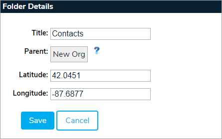
Folder Data
To add lat/long data into a folder, hover your cursor over Admin, then click System Management. Select a folder to display its folder details and enter the information in the Latitude and Longitude fields.
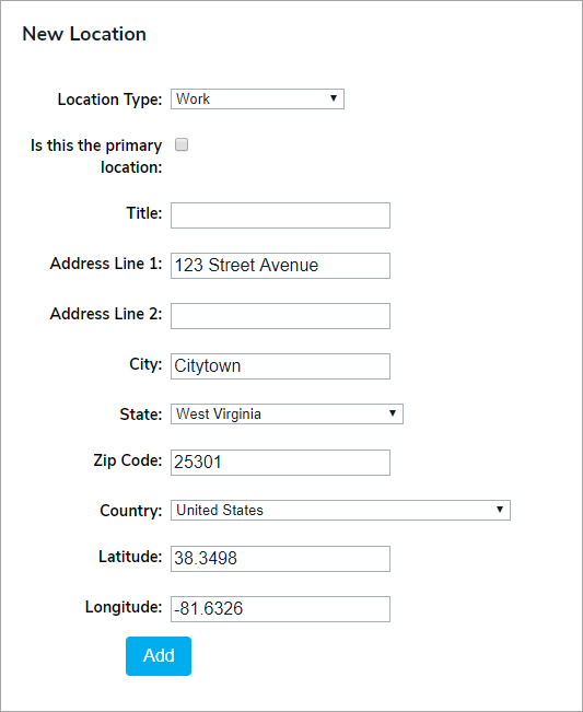
Contact/Resource Locations
You can enter lat/long data in contact and resource records by clicking the Locations tab. Latitude/longitude fields can be included in the import job for supported data objects. Geo encoding services are an optional service.
Using GIS Data in GAL
The GIS service follows the security model within Global AlertLink. Users may only view data for which they have permission. A minimum of Read permission is required for data to be utilized within the GIS services.
The Global AlertLink Advanced Mapping Services feature can be accessed from the main navigation bar on all GAL screens by clicking on the GIS link.

