
The Ability to Load, Save, and Manage External GIS Layers in GAL
We have added the ability for users to load, save, and manage unlimited external GIS layers
used by a variety of GIS and mapping applications to display geospatial data on two-dimensional maps. The formats supported by GAL include KeyHole Markup Language (KML), Keyhole Markup Language Zipped (KMZ), GeoJSON, and GeoRSS. GAL does not supply any default external GIS layers. The user needs to locate and test individual layers for their applicability and usability. For example, the National Oceanic and Atmospheric Administration provide National Weather Data in KML/KMZ formats (http://www.srh.noaa.gov/gis/kml/).
New privileges have been added to Roles to enable a user to edit and delete external GIS layers when using GIS Mapping.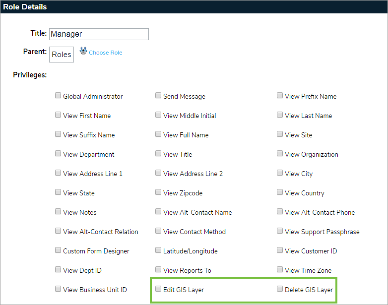
Users can also add GIS layer categories in their referential data to help manage their GIS external layers. External layers can be saved into specific categories for easy retrieval when using Mapping Services.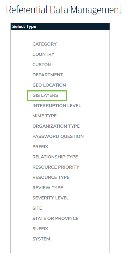
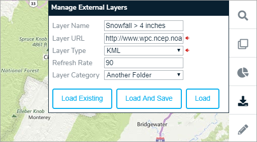
A new button has been added in order to load new or existing external GIS layers. Clicking this button allows the user to specify the URL for the layer, (e.g. this is the URL for areas where snowfall is predicted to be over 4 inches. For example, http://www.wpc.ncep.noaa.gov/kml/winwx/Day1_psnow_gt_04inches.kml).
When you load external layers, you may get the message, "Unable to Load Layer". This indicates that the layer has syntax errors and we cannot load it on the map. This is particularly true for KMZ files that contain multiple KML files. If the KMZ file contains 100 KML files and 1 of them contain syntax errors, the other 99 will not load.
The Ability to Customize the Appearance of Query Layers on the Map
When a user adds a query to GIS (see above for detailed instructions on how to do this), the application adds a query layer to the map, much in the same way it adds an external GIS layer. Remember, these custom form queries must return lat/long data from GAL. Queries without lat/long can be selected but they will not display any results on the map.
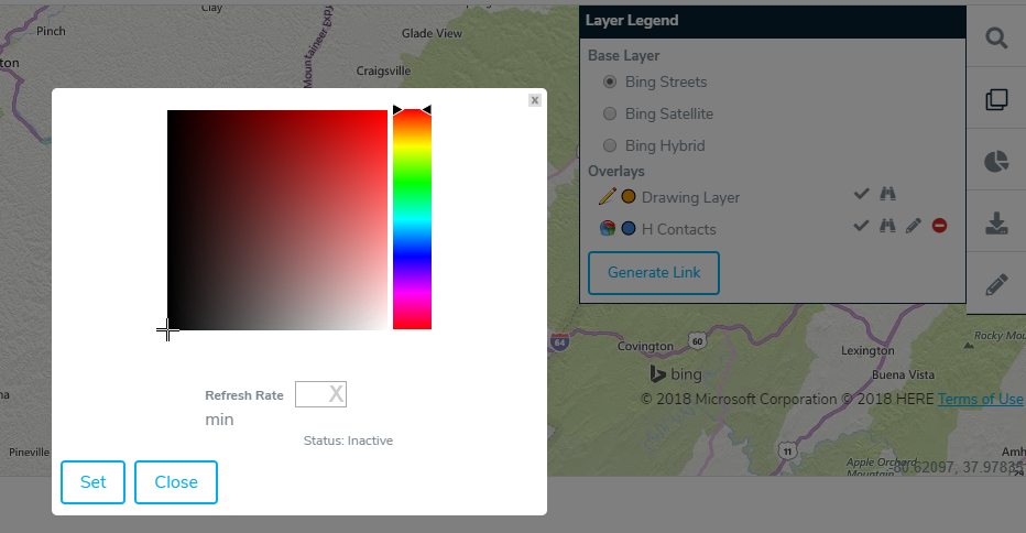
By clicking on the Layer Legend button highlighted, the user can see all of the layers currently active on the map. By clicking on the Edit button, the user can change the refresh intervals for query and GIS layers, or the user can change the color of the query results on the map.
Note: Drawing circles and polygons around a query cluster bubble may not necessarily return the same number of objects in the bubble. Remember, quantities in the cluster bubble are determined by the distance between objects and your configuration settings unlike the drawing layer.
If you have any questions regarding GAL GIS Mapping Services, please feel free to contact a member of the Global AlertLink team at support@resolver.com.

